


.jpeg)


.jpeg)

Fog in many districts of UP, cold wave will blow in Delhi-NCR; chances of rain in many states
Weather: North India is now getting very cold. The morning fog has started in UP. According to the Meteorological Department, fog will be seen continuously for the next few days. At the same time, the cold is troubling due to the cold wave in Delhi NCR. There will be heavy rain in the eastern part during the next two days. Its effect can be seen from Odisha Chhattisgarh to Jharkhand.
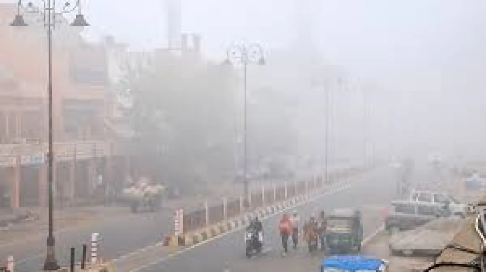
North India is now getting very cold. The morning fog has begun in UP. As per the Meteorological Department, the fog will be seen continuously for the next few days. Meanwhile, the cold is troubling due to the cold wave in Delhi NCR. Cold wave continues in the national capital Delhi, people are resorting to bonfires to avoid the cold.
Due to the effect of cyclonic circulation in the southern Bay of Bengal and western disturbance in the mountains of the north, the weather in a large part of the country is going to change in the last week of December. On 28-29 December, conditions are being created for rain in North India including Haryana, Delhi, Punjab, Western Uttar Pradesh, Rajasthan, and Gujarat. The rest of Madhya Pradesh and Uttar Pradesh will also not be left out.
There will be good rain here too. Due to this, the sky will remain clear for the next three to four days. There will be a slight drop in the minimum temperature. Cold may mix in the Christmas atmosphere. However, the Meteorological Department (IMD) believes that such a situation will last only for a few days. The effect of cold cannot remain intense for a long time. There is a possibility of cold wave conditions in many parts of North-West India during the next five to seven days.
Actually, the temperature in the winter season in North India depends on the western disturbance. Due to its late arrival, the onset of cold was delayed last year as well. This time also the western disturbance has become active late. The western disturbances that came in November were quite weak. The wind speed was also slow, due to which pollution was increasing. This year so far only one disturbance has come strong. The western disturbance that became active a day ago is also very weak, due to which snowfall has occurred only on the high mountains.
The impact of wind till Delhi is very weak. Another disturbance is going to come by 26-27 December. During this time, winds carrying a lot of moisture from the Bay of Bengal in the southeast will come, due to which cyclonic circulation will be formed in the area adjoining Punjab, Haryana, Delhi, and eastern Rajasthan. Due to its effect, it will rain.
Meanwhile, the north wind blowing around Delhi is likely to remain weak for two to three days. Due to this, the fog can become dense. The weather in Himachal and Uttarakhand will remain normal. The temperature in Delhi and Haryana is between five to eight degrees these days. Meanwhile, weather activities will continue in the southern part of the country as well.
The Meteorological Department has forecast heavy rain in the eastern part for the next two days due to low pressure in the Bay of Bengal. Its effect can be from Odisha, and Chhattisgarh to Jharkhand. Today, the cold wave will continue in six districts of Himachal, Bilaspur, Chamba, Hamirpur, Kangra, Mandi, and Una. The Meteorological Department has issued an orange alert in this regard. A warning has been issued for fog in the plains.
For Latest News update Subscribe to Sangri Today's Broadcast channels on Google News | Telegram | WhatsApp